With everything that has been going on (defense, moving, etc.), I realize that I have fallen way behind with my blogging! So here is the final update from my Peru field trip, I hope you enjoy!
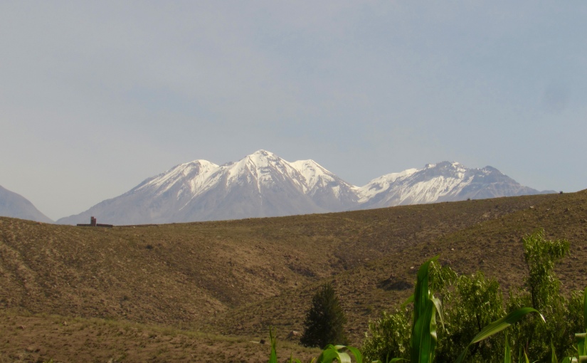
Some of the snow-capped volcanoes around Arequipa
For the last leg of my Peru trip, I journeyed to Southern Peru, specifically to the area around Arequipa, which was a Spanish colonial city nested in a valley around several volcanoes. Here I had pretty good success working with two of my target hummingbird species – Peruvian sheartail (video of display, side video) and oasis hummingbird (video of display, side video).
A male oasis hummingbird (Thaumastura vesper; formerly Rhodopis vesper)A Peruvian sheartail male (Thaumastura cora)
I stayed at a wonderful hotel outside of the city, which was great because I could walk to one of my field sites that was just outside of town. At this field site, along many farm plots, wound a creek along some desert hills. It was among these hills and the creek bed where I found both species holding territories and displaying.
A Peruvian sheartail perching in his territory
My other field site was about 2 hours away from town, along another riverbed, but in a much more desert-based habitat, as you can see from these pictures.
At this field site, I was looking for the elusive purple-collared woodstar, and while I never was able to work with them, I found some additional oasis hummingbirds. The best part about this field site, is that I caught an oasis hummingbird male with my bare hand!! It was hanging out near the female in her cage, as in the blow photos, and I just quickly pinned it against the cage and was able to capture it. (it was not hurt in any way!) So that was an awesome moment for me in my research.
Overall, I loved the area around Arequipa. It was a beautiful place, surrounded by these snow-capped volcanoes, and the people were very friendly. I had a great time working with my wonderful field assistant, Carla Llerena Quiroz, and visiting the university/museum of my collaborator, Mauricio Ugarte at El Museo de Historia Natural de la Universidad Nacional San Augustin, where I gave a seminar for them. All in all, this leg of my trip was very successful, and I then returned to the US to begin analyzing those data I collected and wrapping up my dissertation. More on all that in the future, so for now, here are a few additional photos from highlights of my Arequipa trip:
A Peruvian sheartail nestThe awkward way we have to drive with our mist-net poles to the field (we drove like this for over an hour).The famous giant hummingbird (Patagona gigas), which can weigh up to 25 grams!The super barren desert around Arequipa, which makes the deserts around Phoenix look like lush tropical rainforests in comparison.
While doing my fieldwork in Peru, I took a short trip to Cusco to visit Machu Picchu, and the other surrounding Inca ruins/temples, with my sister who visited me from Connecticut! For those who do not know, Machu Picchu is probably the largest tourist attraction in South America, and for good reason – it was spectacular. The Incas were one of the many native peoples that lived in Peru, and they formed a giant empire in the Andes Mountains between 1438 and 1572. The current city of Cusco, was at the heart of this empire, and a very important site for the Incas, spiritually and logistically.
The city of Cusco.
The Incas also built many temples and complexes near Cusco, with the most famous being Machu Picchu, which was never discovered by the Spanish Conquistadors. While the Inca empire was vast and had achieved many technological innovations, especially with agriculture, architecture, and astronomy, the Spanish Conquistadors unfortunately brutally conquered the Incas and many of their discoveries have been lost. Luckily, modern science has been a great help in uncovering the secrets of Machu Picchu and other Inca sites.
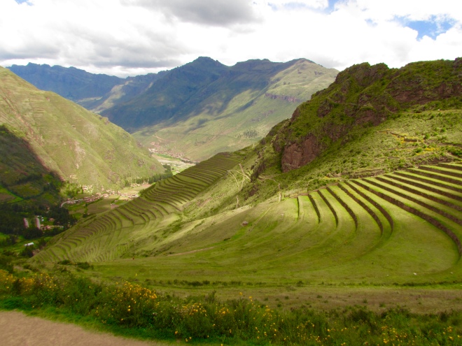
Part of the Sacred Valley.
During our travels around Cusco, we first visited a place called the Sacred Valley – it is the valley between Cusco and Machu Picchu. Along this valley are many interesting ruins, several churches that the Spanish built on top of Inca temples, and groups of people who still carry out many of the Inca traditions, and I was able to visit many of these places. We first visited the town of Chinchero where we saw one of the Spanish churches that was built on top of an Inca temple.
The church at Chinchero, which was built upon the foundations of the Inca tempe.
We were also able to watch how people weave alpaca fur together and use many different natural ingredients to dye woven materials into many different colors.
Women from Chinchero using natural ingredients to dye alpaca fur for weaving.All the different natural ingredients used for dying.The result of the dyes.
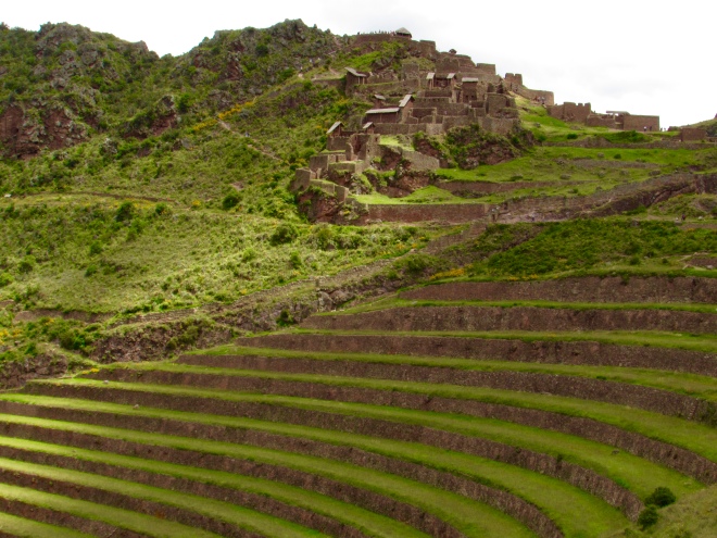
Then, we visited the town of Pisac and went to the Inca complex found there. At this complex, we learned how the Incas built their temples with specific designs that incorporated the movement of the sun and the moon. The Incas were brilliant astronomers and used their knowledge of the sun, moon, and stars to understand seasonal and weather patterns to help their agriculture. Here are a few pictures of the complex at Pisac:
The many terraces at Pisac, used for farming.One of the habitable parts of the Pisac complex.The lower part of the Pisac complex.
After Pisac, we visited to the town of Ollantaytambo, at which is located the famous Temple of the Sun. This temple is particularly interesting because of the amazing architecture and engineering abilities of the Incas. If you look at these pictures, you can see how they managed to fit different giant stones together, without mortar, almost perfectly.
The terraces leading up to the Temple of the Sun.The ruins of the Temple of the SunExamples of how the Incas fit different stones together like a puzzle.Another example of the architectural advances of the Incas.
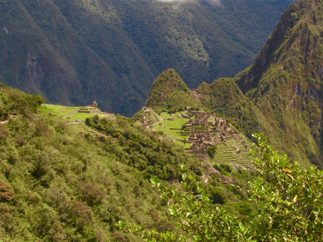
From Ollantaytambo we took a train to Aguas Calientes to spend the night, before heading up to Machu Picchu. Our visit to Machu Picchu was awe-inspiring. In the morning it was very cloudy and misty, giving it a mystical feeling, and by mid-day the sun came out, which gave us a great view of the entire complex. Here were learned about the significance of the complex and how it was laid out, with brilliant city planning and lots of terraces for agriculture to feed the people.
Mist-covered Machu Picchu.A more clear view of the Machu Picchu complex.A view from inside the main square of the Machu Picchu complex.A full view of Machu Picchu.A distant view of Machu Picchu, showing the many terraces surrounding the complex.
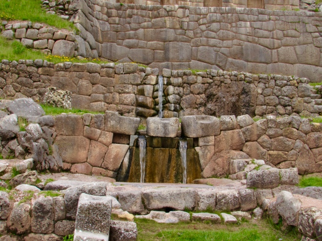
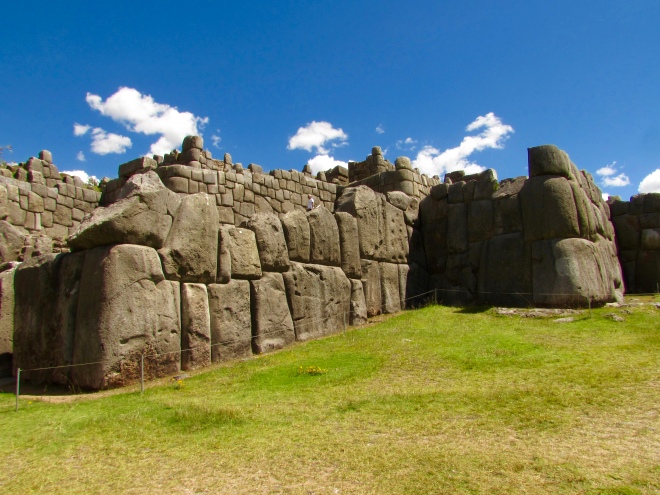
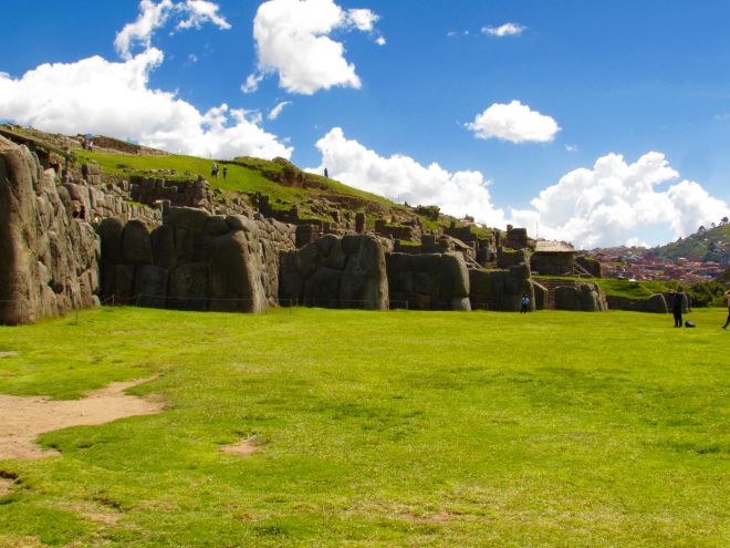
After our tour of Machu Picchu, we took the train back to Ollantaytambo, and then a car back to Cusco. The next day, we visited various ruins around Cusco, including the famous temple Saqsaywaman. We learned about the specific meanings of all the different ruins, and how the Incas used water channels and natural springs to spread water throughout the Cusco area, similar to how they did in Machu Picchu too.
An example of the water delivery systems of the Incas.The ruins of Saqsaywaman.Another view of Saqsaywaman.
Finally, we visited many of the museums in Cusco, which were very informative and a great follow up to our tours of the Inca ruins and Machu Picchu. Unfortunately, we were not allowed to take photographs in these museums, so I cannot show much from them.
A view of Machu Picchu through one of the inner city gates.The beautiful mountains and cloud forests surrounding Machu Picchu.
We were fortunate enough to visit these places in the low season, so there were much fewer people, which I would recommend. The high season is between May and October (I believe) and there are huge, huge crowds during that time. Overall, I would highly recommend everyone to visit Cusco, the Sacred Valley, and Machu Picchu. It definitely lives up to the hype, and I thought exceeded it.
Finally, given that this post was mostly an overview of my visit, if you are interested in learning more about a specific place/ruin/topic please let me know!
That’s right, I am back in Peru right now studying hummingbirds. I know, it is a bit crazy for me to be gathering data the semester I plan to graduate, but I got a grant to travel to Peru, and I am not about to say no to that!
Anyways, this trip to Peru is much more structured than last time. Last time, I was scouting the country and searching for field sites. Now that I have field sites, I am staying those places for longer periods of time. Right now, I am in Northern Peru three weeks. I am currently staying at the Center for the Spectacled Bear Conservation Society (SBC), in a small town called Batangrande. It is a family run field station that is near the Andes Mountains and in the tropical dry forests unique to this region (called Tumbes). It is also a great location to study two species of hummingbirds: short-tailed woodstar (Myrmia micrura) and purple-collared woodstar (Myrtis fanny).
A short-tailed woodstar male.
So far, things are going well. I have found territories of multiple males for both species, including over 10 territories for the short-tailed woodstar. Now I am working to trap a female of each species and use her to film the courtship dances of the males.
A purple-collared woodstar female.
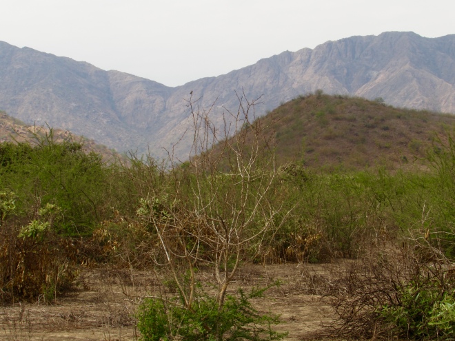
The short-tailed woodstar, which is a species somewhat endemic to the Tumbes region, is a tiny hummingbird with a ridiculously small tail (that is actually what it says in the bird guide book). The males have an iridescent purple gorget (throat patch) and sing a song similar to the Costa’s hummingbirds in the US. They live in the tropical dry forests here, which are a very interesting habitat. It is very hot and sunny here, but the habitat is different than many I have visited in Peru. Here are some pictures of the dry forests:
Another short-tailed woodstar male.The dry forests of Northern Peru(can you find the hummingbird?).Another photo of the dry forests of Northern Peru (can you find the hummingbird?).A dry riverbed within the dry forests.A scarlet-backed woodpecker (Viniliornis callonotus)A Peruvian meadowlark (Leistes bellicosa).A burrowing owl (Athene cunicularia) that I scared up into the tree accidentally.
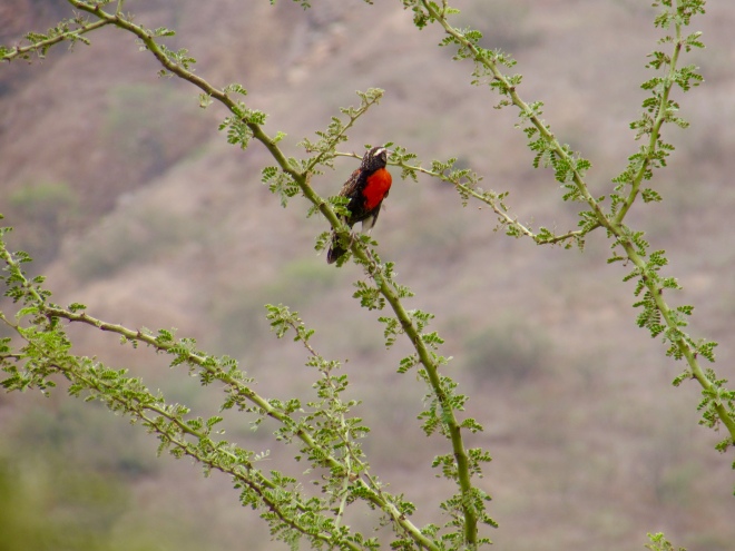
The purple-collared woodstar, is much more widespread in Peru, but tends to live at higher elevations. For them, we drive up into the Andes until about 6,500 ft (2,000 meters), and work in the montane scrub and agriculture areas there. I like these sites because they are much cooler than the dry forest below, and the mountains are very beautiful. This species has been a bit weird for me, because we have found many, many females, but only a few males. But the males we found will work just fine, and I have already seen them display naturally to females, which is a great sign! The purple-collared woodstar is especially interesting to me because of the color of its gorget. Most of the species in the group of hummingbirds I study (the bee hummingbirds) have purple, pink, or red gorgets, but the purple-collared woodstar has a greenish-blue iridescent gorget. I do not have any great pictures of the males yet, but here is the habitat in which we have found them, and a photo of the male from the side:
A male purple-collared woodstar, and you can see his blue gorget at the edge.Some of the montane scrub where we find the purple-collared woodstar.A riverbed, with some water, up in the mountains.Another view of the montane scrub.A male hepatic tanager (Piranga flava).
That is all I have for now, but I should have videos of courtship displays and photos of males that I have captured soon!
The costal deserts of Central and Southern Peru, combined with the costal deserts of Northern Chile, are some of the driest places in the world. The Atacoma desert in Northern Chile is, to my knowledge, THE driest place in the world (excluding the poles). These deserts (including Lima, the Peruvian capital) typically get 0.2-0.6 inches (5-15 mm) of rain a year. In comparison, Phoenix gets around 8 inches (200 mm) a year, and Death Valley gets around 2.4 inches (60 mm) a year. This incredible lack of rain in these Peruvian deserts leads to some very, very barren areas. As I drove around the deserts of Central Peru, there was very little growing anywhere. It made the Sonoran deserts around Phoenix seem like a lush tropical rainforest in comparison.
The dry, barren Peruvian desert.The lush (in comparison to the image above) Sonoran desert.
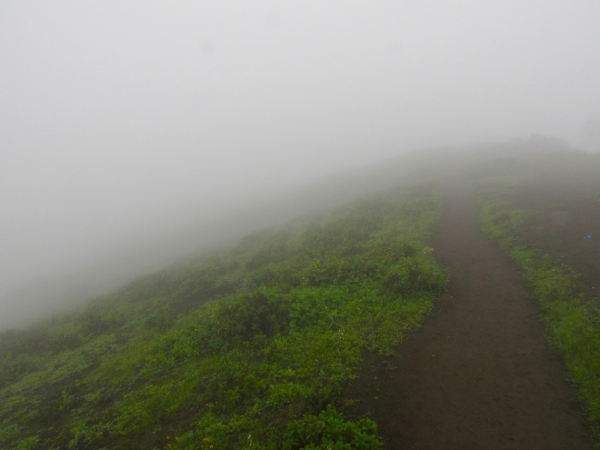
But, despite this dryness, there is life to be found in these deserts if you know where to look. During certain times of year, water filled costal air blows onto land and gets carried upwards by the immediate slopes of the Andes Mountains. At low elevations (~300-1500 ft; 100-500m), this causes dense blankets of fog and mist to form and settle on the land. While it still does not rain, many plants and animals have adapted to secure water from this different source. This has led to the creation of mist oases – called “lomas” in Peru. I visited two of these places, and they were probably the most unique habitats I have visited in my life.
The first lomas I visited is a well known and popular national reserve called Lomas Lachay, which is north of Lima. As I was driving on the Pan-American highway, I was amazed by just how barren the desert was out there. Then I turned off the highway on this dirt road that started going up into the mountains. After a short while, the mist got thicker and the ground turned from sand to a sort of black bio-crust.
The black bio-crust I saw on my drive up to the lomas.More of the bio-crust, with some grasses or mosses mixed in.
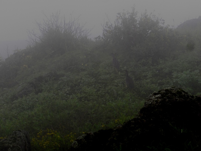
Then I hit the lomas, and was completely blown away. Suddenly in front of me was a lush green carpet of vines and bushy plants, shrouded in the densest mist I have ever seen.
I continued driving on the muddy road in the reserve to the beautiful songs of Peruvian meadowlarks, which are red unlike our yellow meadowlarks.
I then hiked around on these very muddy trails (from all the fog). Some of these trails quite steep, and I had some difficulty keeping my footing on the downhills. I spent several hours at this place, looking for hummingbirds, and while I was unable to find any, I was able to deeply enjoy this wonderful reserve and mist oasis.
This is a rufous-collared sparrow. I probably saw about 100 of these guys at the lomas.
A terrible picture, but an awesome find! These are Andean tinamou
After Lomas Lachay, I went to another lomas – whose name I am still not sure of but I think it is called Lomas Pachacamac. This was not an official reserve, and I actually had to drive around a wall that blocked the main road into it. This lomas did not have as many trees and the mist was a bit less dense than Lachay, but it was still very lush and green. I tried driving around the area a bit, but the roads were incredibly steep and narrow, so I just walked them. At this place, I found many burrowing owls, which were fun to watch.
One of the many burrowing owls that stared at me as I hiked around.
Overall, these experiences in these mist oases were just astounding. I am very curious to visit them when I return to Peru in February, because the costal wet season will be over, and they will potentially be dried up. I am not sure what the wildlife does at that point, but I will try to figure out it next time I visit! I hope you enjoyed this post on these unique mist oases, and my next post will be about my wonderful trip to the Central Andes of Peru!
I am currently in the wonderful country Peru as part of a two-trip research venture to study Peruvian hummingbirds. I am expanding my current dissertation from the six species I have focused on in the US to closely related species in Peru. I will talk more about my specific research plans in a later post, but for this first post, I wanted to talk about the incredible diversity of habitats and environments that can be found in Peru.
A view near the highest elevation I’ve been in my life (4818 m or ~15800 ft) in the Central Andes.
Peru is a fairly large country, roughly twice the size of Texas or just a little smaller than Alaska. Here is an image from the CIA’s website to illustrate the size of Peru compared to the US.
For biodiversity, in the US and Canada, you can find around 900 species of birds, which is quite a large number. However in Peru, there are over 1800 species of birds, which is one of the highest numbers in the world. And that is just birds. There are over 500 species of mammals, 600 species of reptiles and amphibians, tens of thousands of insect species (including over 4000 butterfly species), and over 20000 species of plants. Those are incredible numbers, but how does Peru obtain such biodiversity? Through a combination of the Amazon Rainforest, Andes Mountains, and the Pacific Ocean.
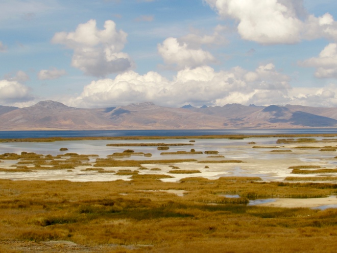
A view of Lake Junín and its surrounding wetlands in the Central Andes (~4000 m or 13,000 ft).
Peru can broadly be broken down into three distinct regions: 1) the desert coast; 2) the sierra (Andes Mountains); 3) the Amazon. These regions vary from west to east, with the coast on the west and Amazon on the east. Peru can further be broken down from north to south. Northern Peru has some of the lowest mountains in the Andean chain and is close to the Equator, which leads to very different seasonality and the presence of tropical dry forests near the coast instead of just barren desert. Central and Southern Peru are somewhat similar, but the Andes are wider and higher (on average) in Southern Peru.
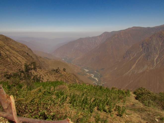
Looking down into the Santa Eulalia Valley on the west slopes of the Andes Mountains.
The Andes Mountains dictate much of the biodiversity in Peru, though the Amazon contributes a ton as well. Peru’s mountains have a very dry west slope, which is fairly close to the Pacific coast, and a very humid and wet east slope. In the middle, there are several large plateaus and valleys, that have their own unique properties, such as the Marañon, or temperate deciduous forests, in Northern Peru’s Andean valleys, and the high elevation, cold and dry Puna grasslands found in throughout the high Andes (over 3500 m or 11500 ft). As you move up in elevation on both slopes, but especially the east slope, the plant and animal compositions change drastically. This can be best witnessed on the east slope, as you start in specialized high elevation humid forests, such as Elfin forests, and then descend into typical cloud forests, which harbor amazing biodiversity, before dropping into the varied and vast lowland Amazon rainforest.
The cloud forests on the east slopes of the Andes, in Central Peru
So far, I have mostly stuck to the coast and west slopes of Peru. I have spent most of my time in Lima, which is the capital of Peru, and in the Peruvian coastal desert. Peru’s coastal desert is one of the driest places in the world, but also is home to the spectacular mist oases, called Lomas.
A view of the mysterious and spectacular mist oases in the super dry Peruvian desert. This is at Lomas de Lachay.
I made two trips into the Andes from Lima, one sticking on the west slopes, and one going into the heart of the Central Andes, where I hit 4818 m (~15800 ft) and explored the Puna grasslands and a high elevation lake named Lago Junín. While I was in the Central Andes, I did take a day-trip to the east slope cloud forests, which allowed me to see a completely different side of Peru. I also took a five-day trip to Northern Peru, still sticking to the coast, but where I explored Peru’s tropical dry forests. Overall, I have only explored a small bit of Peru, but it has been am amazing visit full of many unique experiences for me! Over the next several posts, I will document these experiences, and then next Spring (for us) I will return to Peru to continue my work on hummingbirds!
A pristine tropical dry forest of Northern Peru (photo a bit washed out). This is at the Santuario Historico Bosque de Pomac.
In the beginning of May, I traveled to Michigan to visit my sister, who took us on a great adventure while I visited. I had never been to Michigan and was not sure what to expect, but what I saw was a wonderful surprise to me. We journeyed to the Upper Peninsula (UP) and visited some national lake shores and state parks, all of which were quite beautiful! But as mentioned in the title, it was very cold in the UP – with windchill it was in the 20s F, so that was very different from the 90-100 degree weather from Phoenix! Despite this, I really enjoyed this trip and was able to see some amazing sights of sand dunes, lowland pine forests, and of course the Great Lakes,
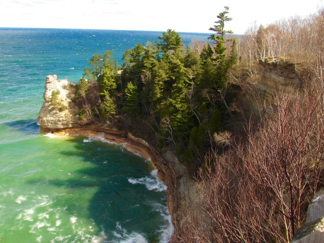
A beach along Lake Superior.
Our first stop was Tahquamenon Falls State Park, which was an inland park in the UP along the Tahquamenon River. Along the lovely pine forests the river was full of beautiful waterfalls, with the lower falls being small and the upper falls quite large. We did a few hikes here and enjoyed the riverside forest and sound of the falls as we did.
The lower falls in Tahquamenon Falls State Park.The upper falls in Tahquamenon Falls State Park.The Tahquamenon River and its lovely riverside forests.A fun chipmunk friend we found.One of the deciduous forests we found in the park.
Then we went to Pictured Rock National Lakeshore. We visited this place twice, once in the evening and once in the morning. Here we found small sand dunes, some blanketed with short and stout pine trees, and other bare or with some grass. After hiking along the dunes for a bit, I was given my first real view of Lake Superior. And wow was it a sight to behold! I still cannot believe that I was looking at a lake and not the ocean.
Some of the smaller sand dunes near Lake Superior.My first view of Lake Superior from the sand dunes.A male ruffed grouse we found along the trail.A small river that lead to Lake Superior.
We also visited some of the more famous points of the lakeshore – namely where the place gets its name: the pictured rocks. These rock walls looked like the product of uncountable years of erosion from the lake’s powerful waves and the strong winds. They were very pretty and had the wind not been so strong (making it very cold) we could have stayed there for a long while. We also visited a few beaches along Lake Superior within the national lakeshore. These were just like those you would find in the ocean; smooth, soft sand glowing blue-green water. It was remarkable, because if the weather had just been warm, I would have thought I was somewhere in Southern California or Florida.
Some of the famous pictured rocks along Lake Superior.More of the beautiful pictured rocks.One of the amazing beaches along Lake Superior.A view of another coast along Lake Superior with its beautiful green-blue water.A view along the sandy shore of Lake Superior.
After Pictured Rock National Lakeshore, we left the main part of the UP and visited Sleeping Bear Dunes National Lakeshore/State Park. Here we climbed massive sand dunes that seemed to spring out of know where. It was quite strange seeing these massive sand dunes surrounded by temperate forests, but they were very fun to climb. We hiked across them for quite a ways towards Lake Michigan, and after a long hike, we finally made it to that lake’s beach. It was fun to see the different plant and animal life living in the dunes, including trees, which must have a rough time staying put as the dunes shift!
Looking up at the giant sand dunes at Sleeping Bear Dunes.Looking across the Sleeping Bear Dunes at the grass and trees living up there.Looking at Lake Michigan over the sand dunes.The sandy shore along Lake Michigan.Another view of the shore along Lake Michigan.
Overall, I had a wonderful time visiting Michigan and was blown away by its beauty and spender, especially with regards to its beaches, sand dunes, and forests. I highly recommend everyone to visit the Upper Peninsula of Michigan, though I would recommend you visit when it is a bit warmer! Finally, a want to give a huge thank you to my sister for showing us the wonders of Michigan and the UP!
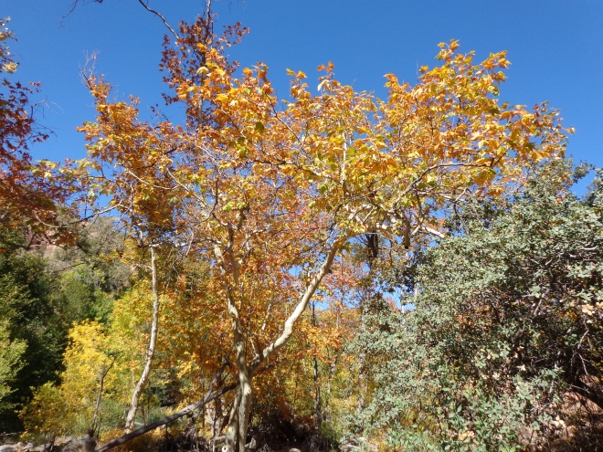
Looking up at the beautiful aspen trees in Flagstaff, AZ.
I have never really grown up somewhere with four seasons. In Houston and San Antonio, there were really only two seasons: hot + humid and less hot + humid. Now in Phoenix, we have seasons, but it is more of a wet/dry seasonality, with two monsoon seasons a year (summer, winter). And it does actually get consistently cold in Phoenix, unlike what I remember about growing up in Texas, where one week would be in the 40s and the next in the 90s.
The only “snow day” we had while I was at Trinity University in San Antonio, TX. Look at all that snow…..
This is not to say I have never experienced seasons though. Summer I have nailed down quite well at this point…. Spring I have seen too, as every place I have lived does have a spring-like season, in that flowers bloom, animals start becoming active and breeding, and it starts to “warm up” (aka. go from warm to hot). Winter is tricky. Like I said, it does get cold and stay cold in Phoenix (cold for us at least!), but I’ve never had a true snowy winter. There were the occasional bouts of snow in Houston or San Antonio (see picture above), but it would only snow 1/4 inch and be gone the next day. Whenever I went skiing, I saw snow of course, and I have been to Flagstaff, AZ in the winter where I saw plenty of snow, but I have never lived in it. So I have some experiences but much.
My favorite picture of the San Francisco peaks with snow, near Flagstaff, AZ.Mormon Lake frozen over with snow, near Flagstaff, AZSpring in the high elevation meadows of the Sierra Nevada Mountains, near Lake Tahoe.Palo Verde trees turn yellow in the spring, but not because of their leaves – they have yellow flowers.
However, Fall is the season I probably have the least amount of experience with. I’ve lived in places with the occasional tree that would change color, but mostly leaves went brown and did not look pretty. Here in Phoenix, there are not many deciduous trees, so nothing really changes color, but luckily there are plenty of places in Arizona where you can go to see fall colors! It may not be as colorful as New England, but it is still pretty amazing.
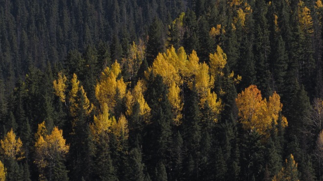
More aspen trees with their beautiful yellow leaves, Flagstaff, AZ.
When Fall approaches, the first places to visit are the high elevation mountains of Arizona. Either Flagstaff or the White Mountains (especially around Greer) are particularly beautiful! You will only see one tree change color, the aspen tree, but it can range from a orangish-yellow to a neon yellow. Aspens are my favorite tree, because regardless of the color of their leaves, their leaves contrast so strikingly against their white bark, which I think is very beautiful. They also grow in strands, so you will get huge bursts of color dotting the landscape. Sometimes when you are hiking in the pine forests, you will find singular trees, which seem like torches lighting up the place. All if it is beautiful, but my favorite is when aspen strands take over large swaths of land and the bright yellow is everywhere.
Torches amongst the pine trees!The color variation in the aspen trees – orangish to neon yellow.More beautiful aspens found in the White Mountains of Arizona.This is what it looks like when aspen trees take over a landscape – this photos is actually from a mountain range in Utah. Photo credit – Meghan Duell.This aspen strand took over a mountain side in the White Mountains of Arizona.
Another excellent place to visit is the riparian areas of the sky islands in Southeast Arizona. I visited Ramsey Canyon in the Huachuca Mountains one Fall, and there I saw a great diversity of trees change color. My favorite was the Arizona sycamore, which would turn a bright orange that also contrasts beautifully against its white bark.
A bouquet of colorful trees in Ramsey Canyon (including the Arizona sycamore).
Later into Fall, the lower elevation riparian areas start changing as well. One of my favorite places to go is Oak Creek Canyon, however it is a lot of people’s favorite place, so it will be crowded. Sometimes it is enough to just drive through that canyon during fall, because you really get to see such a diversity of colors as you go from roughly 4000 ft to 7000 ft. You get the Arizona sycamores again, but also many other trees and many other colors. This might be the most color-diverse place I’ve been into Arizona so far.
The many different riparian trees changing color along Oak Creek.Another view of Oak Creek fall colors.Some of the color variation found within Oak Creek Canyon.A view looking out of Oak Creek Canyon with the red rocks adding to the color variation.
I have heard of other places to visit to see fall colors, but I have yet to go there. Prescott is supposed to be a great place to see colors, and I still need to visit the Chiricahua Mountains and Madera Canyon in the Santa Rita Mountains. The North Rim of the Grant Canyon is supposed to have some beautiful strands of aspen trees as well. If you know of any other good places to visit in Arizona to see Fall colors, please let me know!
Well, it is still hot in Tempe…. surprise surprise. So to cool off, I fled the mountains of Arizona and California over the past two weekends. First I went car camping in the White Mountains in Eastern Arizona, and got hailed on again. BUT, I was in my car the whole time so it was fine! The second trip was cabining near Big Bear Lake, CA with my long time friend Steve and his girlfriend Stacey. Both were great trips, where I was able to get nice and cool (especially while camping!) and enjoy some beautiful hikes and breath-taking views!
A view across the Blue Range Primitive Area in the White Mountains
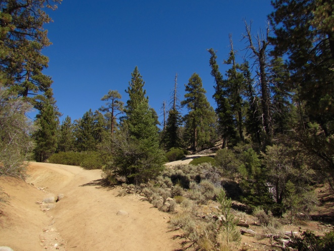
For those who are new to this blog, I adore the White Mountains in Arizona. The White Mountains are a large range along in central-eastern Arizona, full of high-elevation mixed coniferous forests and aspen trees. They also seem to get quite a bit more water than other high-elevation places in the state, like Flagstaff, because there is a lot of moss and lichen all around. The forests here have actually be called similar to those found in Washington and Oregon. And of course, since it was monsoon season, it was still raining quite a bit in the mountains, and I actually lost half a day of hiking because of a storm (so I napped in my car). Another thing I like about the White Mountains is that they are so remote – a 4 to 5 hour drive from Phoenix – so that there are few people in the area. Yes, I am a slightly anti-social camper, mostly because whenever I seem to camp around other people they are loud or blaring music. #getoffmylawn
One of my camping spots during the trip; it was in the middle of no where with no one around = quite and peaceful
I spent my first day near the town of Greer in the northern part of the mountains. I hiked a local trail called Squirrel Spring Trail, which was nice forest hike. Then I camped at an established campground called Winn Campground, which is where I had stayed before. It is a fairly large campground on top of a forested hill that I have never seen close to full. Unfortunately I did not get to spend much time there the next day, because it started raining at 7:00 AM. I had luckily just finished packing up, so I left and headed south on Highway 191, which is just a gorgeous drive through the mountains. I ended up picking a random side road at some point in a gap of rain to cook breakfast, since I did not have time to eat before the rain. After a nice breakfast I then drove to a trailhead near the Blue Range Primitive area, where I napped until the rain and hail stopped. Then I started along the trail, but was immediately disappointed. This trail had been completely burned from the 2011 fire that ravaged this area, and the nice forested hike I read about was no longer there:
The landscape around Greer, AZ.A hike through the forests around Greer, AZ.The recovering burned area in the Blue Range Primitive Area.An example of how extensive the 2011 Wallow Fire burned areas are in the White Mountains.
After 45 minutes of hiking along this trail, I turned around and decided to find another trail. Luckily, just down the road was another trial that had been mostly spared, so I got another lovely forested hike, but with a different tree make-up from the Squirrel Spring Trail. Then after hiking along that trail for a while – not as long as I wanted as my phone kept changing time zones because I was close to the New Mexico border – I found a random forest road and camped alongside of it. Here are my photos from the hike:
The lush, green understory of the forests in the White MountainsAnother view of the forest, showing some trees with mosses and lichen on them.A small strand of aspen trees through the forest.This was one of the burned areas, and hiking through this patch of thistles on the trail was definitely not fun.
Before I made the sad, long drive back to Phoenix, I explored the lower(ish) elevation part of the Blue Range Primitive Area, and was totally taken aback by what I found. As I was driving, I realized that I was actually descending the Mogollon Rim (very prominent geological feature that cuts across Arizona), and the area reminded me a lot of the Sedona/Oak Creek Canyon area, which was awesome. At the bottom of the road, I was met by Blue River and a lush mid-elevation riparian area with giant cotton woods. I always love going through the transition from this habitat to the high-elevation coniferous forests, and this forest road was a great example of that.
A view across the Blue Range Primitive Area from the road that descended into it.The road from along the Blue River after descending the Mogollon Rim.The lush riparian areas around Blue River.A view from the road as I ascended back up the Mogollon Rim.
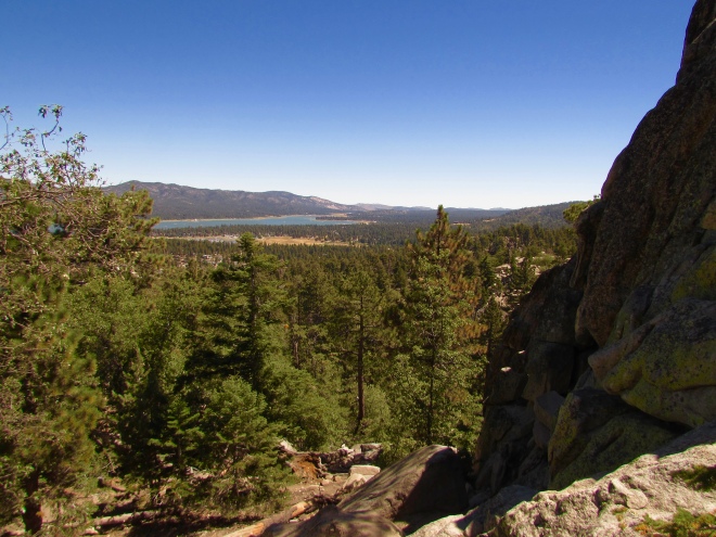
This past weekend – Labor Day weekend – I again escaped the heat and joined my friends in the San Bernardino Mountains near Los Angels. We went to this area/town called Big Bear Lake, which was around 6,500-7,000 ft. Instead of camping, we got a place in town for the weekend and explored the area by car and by hiking. The town was very nice, full of interesting shops and restaurants, and the surrounding area was very beautiful. There are so many activities in the area, much like Lake Tahoe, but smaller, and it seems like a four-season place. While we were visiting, we hiked several trails in the surrounding area, namely Castle Rock and Cougar Crest Trails, giving us great views of the lake. We also explored the many small shops, where we saw some pretty awesome looking woodcrafts. We also explored several of the local restaurants and breweries, so we ate very well!
Myself, Stacey, and Steve a top Castle Rock.A view of Big Bear Lake from Castle Rock.A view of the San Bernardino Mountains from Castle Rock.The forst and ephemeral stream bed along the Cougar Crest Trail.Another view of Big Bear Lake, but from the Cougar Crest Trail, which is on the opposite side of the lake from Castle Rock.An example of the beautiful woodwork found in the town.Another example of some of the woodwork from Big Bear Lake.
Overall, both of these trips were excellent escapes from the heat and very fun times. I cannot wait to continue escaping the heat when I can and also visiting these two places again in the future to further explore them!
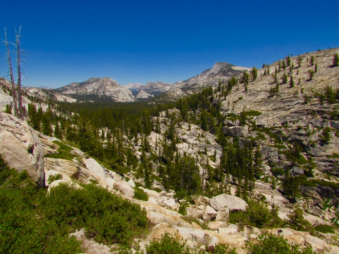
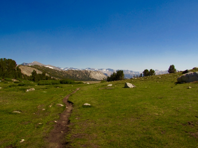
On my way back from Sagehen Creek Field Station to Tempe, AZ, I took two side trips for fun. The first was the afternoon before I left, where I hiked up to the local high point, named Carpenter Ridge. Then on the drive home, I went to Yosemite National Park for several hours and explored the eastern side of the park. Both experiences were excellent, and Yosemite was definitely one of the most beautiful places I have ever been.
The high country of the Sierra Nevada Mountains in Yosemite National Park.
Starting with my trip to Carpenter Ridge, I had to drive along several forest roads, during which I happened upon a mother black bear with two cubs. Unfortunately they were way to fast, and I did not get any pictures. I decided that chasing a mother bear and her cubs to get a photo was probably way to dangerous. Eventually I had to stop driving – because of a huge pile of snow in the middle of the road (in July!) – and walk to the base of Carpenter Ridge. From there, I hiked up a steep slope, rising bout 800 feet in elevation over a short distance, to get to the peak (just under 9,000 ft.). Once I summited the peak, I was met with wonderful views of the surrounding landscape, including Independence Lake, and distant views of many mountain peaks around Lake Tahoe. The plant life was also very interesting, because many of the bushes and small trees were stunted due to the winds. There were many colorful flowers blooming as well. I even saw hummingbirds near the peak! Below are some of the pictures I took during this trek.
The road leading to the base of Carpenter Ridge (the peak in the background).A view of Independence Lake from Carpenter Ridge.Looking towards Lake Tahoe (not seen) from the peak.Some of the interesting and stunted plant life on top of the peak.A view of several high peaks in the Sierra Nevada Mountains near lake Tahoe.Some of the flowers and shorter plants growing at the peak.These pretty purple/blue flowers were often visited by hummingbirds.The trees around the ridge were covered in moss and lichen, which made the forest look very green and alive.These pink flowers had the most interesting leaves.
Then on my drive home, I decided to stop by Yosemite National Park, because I had never been there before. I entered through the eastern entrance, which is around a 2.5 hour drive from the famous Yosemite Valley. Because of that long drive and the fact that the valley would be packed with people, I decided to save that place for another trip. Instead I explored three other famous locations in the high country of Yosemite National Park. I say high country, because for the most part, I was hiking between 8,000 and 11,000 feet. The first place I visited was Olmsted Point, which provides great views of the eastern part of Yosemite Valley and both the Cloud’s Rest and Half Dome peaks.
A view down Yosemite Valley from Olmsted Point, with Cloud’s Rest and Half Dome peaks in the background.Another view from Olmsted point, in the opposite direction from Yosemite Valley.Looking towards Tenaya Lake from Olmsted Point.Another great view from Olmsted Point – there were many great views!
There is also a short (1.5 mile) trail that goes between Olmsted Point and Tenaya Lake, a beautiful high elevation lake at around 8,200 ft. I was able to get some great photos of the lake with the mountains being reflected on its surface. The hike between the two points also took me through several meadows, where I was able to see some pretty flowers and wildlife.
Tenaya Lake beautifully reflecting the nearby scenery.One of the many meadows on the trail between Tenaya Lake and Olmsted Point.A very wet and marshy meadow along the trail.A male deer with his antlers covered in velvet.A wash near the lake.Another view of Tenaya Lake with the mountains being reflected by the water.A zoomed in view of the mountains behind Tenaya Lake.
From there, I drove through the Tuolumne Meadows and did a hike up to the Gaylor Lakes. This trail not only provided me excellent views of the meadows, but once I crossed over the ridge towards the Gaylor Lakes, I was able to see many of the higher elevation peaks in Yosemite. There were two main lakes along this trail, a lower and upper lake. They both seem to be fed mostly by snow melt, and there was actually a huge snowbank by the upper lake continuously feeding it while I was there. I also saw several bird species, such as the Clark’s nutcracker, and several high elevation mammals, like the California ground squirrel and yellow-bellied marmot. I heard many of the ground squirrel alarm calls, which was a fun reminder of what I learned in my animal behavior classes – these squirrels tend to live in colonies and always have a few individuals on the lookout for predators, who then give alarm calls when they see a predator to alert everyone else in the colony. Here are my photos of my hike up to the Gaylor Lakes (I took a lot).
The mountains near Tuolumne Meadows.A part of Tuolumne Meadows and the surrounding peaks.A pair of Clark’s NutcrackersA view of the lower Gaylor Lake from a ridge nearby.A view of the lower Gaylor Lake from its shoreline.Part of the Gaylor Lakes Trail.Part of the upper Gaylor Lake.Another view of the rocky area around the lake.A yellow-bellied marmot.The same marmot but on alert.A California ground squirrel.A snowbank melting straight into the Gaylor Lakes!A view of the Sierra Nevada/Yosemite high country from the Gaylor Lakes.The wind creating ripples and waves across the upper Gaylor Lake.A view of the trail passing by the upper Gaylor Lake.Two smaller lakes in the area around the Gaylor Lakes.Another view of the high country.The trail and stream going from the upper lake to the lower lake.
Yosemite was an incredible place to visit. Almost everywhere I looked there were breath-taking views. And while I was only able to explore a small portion of the park, I was completely captivated by its beauty, and cannot wait to go back and visit. I did not realize just how large Yosemite National Park was, and would definitely love to backpack all throughout the park, especially along the legendary John Muir trail!
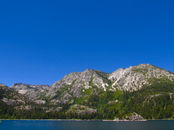
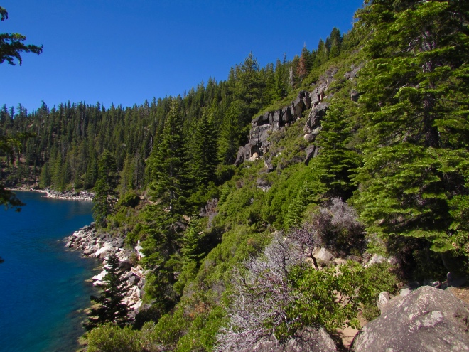
While I was doing fieldwork near Lake Tahoe I took a couple days off to explore the surrounding areas. Of course the first trip I took was to visit Lake Tahoe itself, and it was an amazing trip!
The beautiful blue water of Lake Tahoe
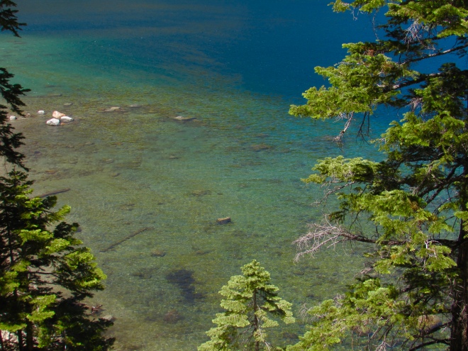
My adventure occurred at D.L. Bliss State Park near Emerald Bay in southern Lake Tahoe. This park has a trail that essentially goes around the entire perimeter of Emerald Bay, which is one of the most famous and pretty areas along Lake Tahoe. The trail was called the Rubicon trail and I hike it for around 13 miles total (to the end and back). Along the trail I was able to do some great birding and see some spectacular views of the lake. This is truly one of the most beautiful places I have ever been. Below are several pictures of Lake Tahoe and Emerald Bay from a variety of viewpoints.
Where Emerald Bay gets its name.
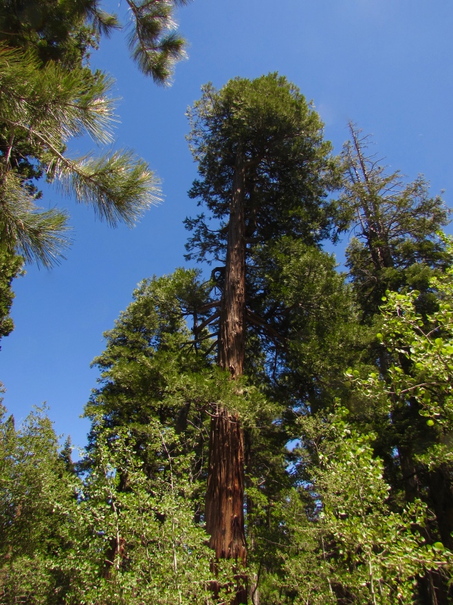
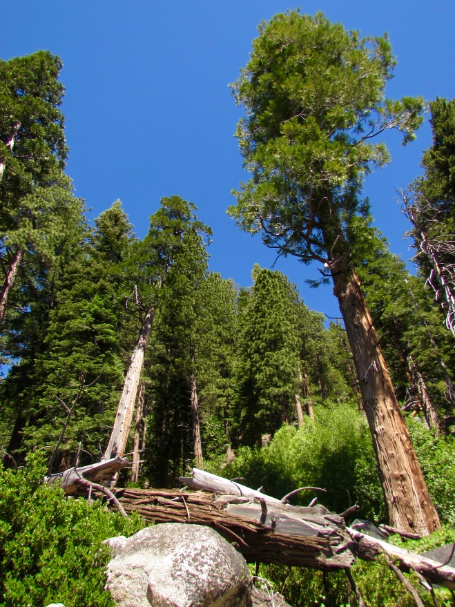
One of the most striking elements of this hike (aside from the lake) was the trees. There were many massive trees, and the forest community kept changing as I moved along the bay. Some areas were dominated by Jeffery pines, while others were very mixed and full of giant cedar trees.
A stream that flowed through a forest from the mountains into the lake, full of pretty waterfalls.One of the giant cedar trees.More of the very tall trees found at various points along the lake.A view of the forest along Emerald Bay.A view of the forest along the lake.A very pretty orchid I found near the shore.A funny surprise I found along the trail.
I was also able to do some great birding here and picked up a few lifers, including a Townsend’s solitaire and white-headed woodpecker. Many of the birds were high up in the tall trees, so I did not get too many good pictures, but here are a few.
There were many osprey nesting around the lake.A female common merganser cleaning herself in the sun.Two Canada geese hanging out near the shore.A great close-up of a Stellar’s jay.
If you ever visit Lake Tahoe, I highly recommend this hike. While there were some places along the trail where there were a larger number of people (near campsites), I mostly had the trail to myself. This was a great trail to get some amazing views of the Lake and see the diversity of forests around it.